Huittinen
 |
The town is unilingually Finnish. Municipality of Vampula was consolidated with Huittinen on 1 January 2009.
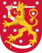
The Huittinen coat of arms is designed by Erkki Honkanen in 1953.
Risto Ryti, the president of Finland in 1940–44, was born in Huittinen in 1889.
In 1904, one of Finland's most famous ancient objects, the Elk's Head of Huittinen from the Stone Age, was found in the village of Palojoki in Huittinen. It is now in the National Museum. In addition to the artefact finds, there is a comb ceramic residence in Korkeakoski and a younger burial site in Sammu village, as well as some cemeteries. Researchers have concluded that the Huittinen got their first inhabitants mainly from the northwest, from the direction of the lower course of the Kokemäenjoki.
Huittinen is mentioned as a churchwarden in 1414. The gray stone church of the Huittinen was built at the end of the 15th century. The church burned down in 1783 and a high tower was added during the repair. On flat terrain, the tower can be seen far into the surroundings. Before the stone church, there was a wooden church in Huittinen.
The Juusela farm in Nanhia village has been considered the seat of the Juslenius family. The most famous member of the family was bishop Daniel Juslenius. Vicar Nils Idman Sr., known for his financial and scientific interests, also came from the same house. Archbishop Erkki Kaila's father, Jonatan Johansson, served as assistant keeper of Huittinen in the 1860s.
Lauttakylä, the center of Huittinen, became Southwest Finland's most important land transport hub long before the age of cars. The railways were far away and the waterways were not navigable for long distances. However, a passenger ship operated from Lauttakylä along the Kokemäenjoki to the Kyttälä railway station on the Tampere–Pori line right from the completion of the line until the 1930s. Lauttakylä was born at the intersection of the old Helsinki–Pori and Turku–Tampere roads, where Loimijoki was crossed by ferry. Bus service from Lauttakylä to all directions started as early as the early 1920s.
Map - Huittinen
Map


Country - Finland
 |
 |
| Flag of Finland | |
Finland was first inhabited around 9000 BC after the Last Glacial Period. The Stone Age introduced several different ceramic styles and cultures. The Bronze Age and Iron Age were characterized by contacts with other cultures in Fennoscandia and the Baltic region. From the late 13th century, Finland became a part of Sweden as a consequence of the Northern Crusades. In 1809, as a result of the Finnish War, Finland became part of the Russian Empire as the autonomous Grand Duchy of Finland, during which Finnish art flourished and the idea of independence began to take hold. In 1906, Finland became the first European state to grant universal suffrage, and the first in the world to give all adult citizens the right to run for public office. After the 1917 Russian Revolution, Finland declared independence from Russia. In 1918, the fledgling state was divided by the Finnish Civil War. During World War II, Finland fought the Soviet Union in the Winter War and the Continuation War, and Nazi Germany in the Lapland War. It subsequently lost parts of its territory, but maintained its independence.
Currency / Language
| ISO | Currency | Symbol | Significant figures |
|---|---|---|---|
| EUR | Euro | € | 2 |
| ISO | Language |
|---|---|
| FI | Finnish language |
| SV | Swedish language |

